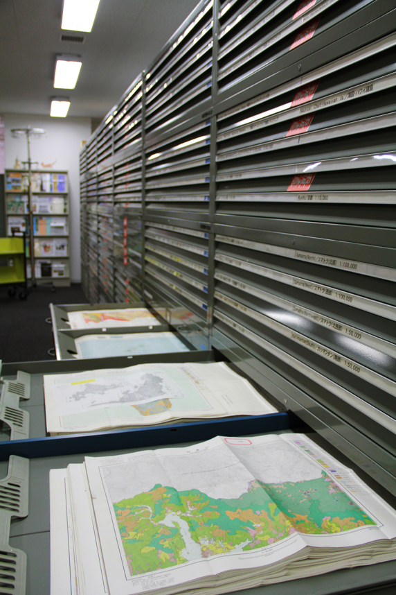
The CSEAS Map & Documents Room holds Southeast Asian maps (approximately 48,000 sheets), the Williams-Hunt Collection of aerial photographs (about 10,000 photographs), and Human Ecology files.
It emphasizes a collection of Southeast Asian maps and extends to map groups of all Asian regions: East Asia, Central Asia, West Asia, Japan, Pacific Islands, and Australia. Types of maps in this room vary from topographic maps to land use maps, geological maps, vegetation maps, and political maps.
Materials in this room were produced in various periods, from pre-World War II to the present day, where the data are collected by aerial survey. Among them, there are so-called Gaihouzu maps created and edited by the former Japanese Imperial Army General Staff Office and Land Survey Department. The Gaihouzu collection consists of approximately 10,000 sheets of geographic and topographic maps, aeronautical charts, and sea charts of the Navy. Maps in this collection cover South Asian, Southeast Asian, and East Asian areas. They are large-scale maps ranging from 1:25,000 to 1:15,000. In addition to that, a collection of Soviet Army topographic mapping of the world is available, which was produced by the Military Topographic Administration under the Soviet Army General Staff office, in cooperation with the Chief Administration of Geodesy and Cartography, an organization responsible for all mapping of USSR. This collection consists of approximately 3,000 sheets of historically essential maps.
Moreover, the Map & Documents Room also provides access to satellite image data and digital data (the digitalization of a part of materials in this room).